28 Jan, 2023
Finished
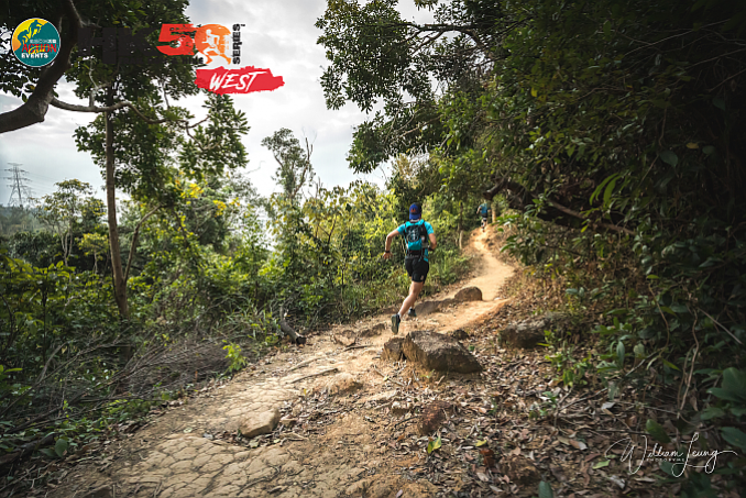
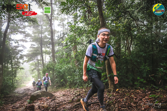
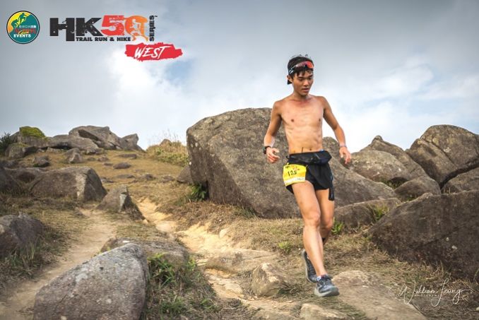
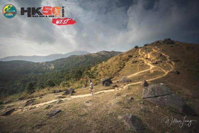
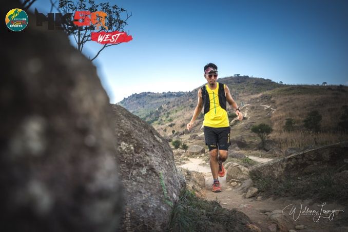
2023 - HK50 WEST - race 3 HK50 Series


Course 比賽路線
(50km) All 50km participants MUST have a headlamp or torch with them and will not be allowed to continue if they don't carry as it will have chance to get into dark during the race. For your own safety all runners must follow the mandatory equipment list under rules & regulations.
Three Distances 3個距離
55Km (55.5Km) - elevation gain 2572m & elevation loss 2572m (Max elev 917m) - 12 hour cut-off
25Km (25.1Km) - elevation gain 1596m & elevation loss 1596m (Max elev 917m) - 7 hour cut-off
(gain/loss keeps changing everytime we change devices so take it with a grain of salt!! - Above gain/loss from Strava but gpx shows a little more)
55公里 (55.5公里) - 總爬升2572米,總下降2572米 (最高點 917米) – 限時 12小時 12 hour cut-off
25公里 (25.1公里) - 總爬升1596米,總下降1596米 (最高點 917米) – 限時 7小時
11Km (10.9Km) - elevation gain 568m & elevation loss 568m (Max elev 592m) - 3.5 hour cut-off
11公里 (10.9公里) - 總爬升568米,總下降568米 (最高點 592米) – 限時 3.5小時
MAPS UPLOADED ON LEFT OF THIS PAGE UNDER DOWNLOAD PDF.
地圖可於左方"Download PDF"下載。
Start & Finish - Shing Mun Reservoir Catchwater, Tsuen Wan (2 minutes walk from Shing Mun Pineapple Dam mini bus stop)
起點及終點 – 城門水塘引水道, 荃灣 (由城門菠蘿壩小巴總站步行2分鐘)
Start & Finish location 起點及終點位置 https://goo.gl/maps/mUh4QX1xJYP2
Google map (anti-clock wise) 2023 -
Course marking - Pink A4 size signs, pink ribbons are used for marking; Green reflective ribbons will be with PINK ribbons together from check point 4 (Tsuen Kam Au) all the way back to finish point.
路線指示 – 賽道會採用粉紅A4尺碼路標及印有 字樣的粉紅色絲帶;檢查站4 (荃錦坳)至終點會以粉紅色絲帶旁加上綠色反光絲帶。

55Km公里 (55.1Km公里)
ITRA Qualify race - Finisher of 55Km race can get 3 points for ITRA Endurance Point
ITRA 資格賽 - 完成55公里賽事可取得ITRA分數(ITRA Endurance Point) - 3分
Please find the details of certified tracks below. 有關認証路線請參閱以下連結。
Strava https://www.strava.com/routes/2893445965767549502
Strava https://www.strava.com/routes/2893445965767549502
GPX - Download GPX file (updated) 下載GPX檔案(更新)
KMZ - 20220217004922-78244-map.kmz
Elevation gain 2572m & elevation loss 2572m (Max elev 917m) - 12 hour cut-off
總爬升2572米,總下降2572米 (最高點 917米) – 限時 12小時
ITRA Qualify race - Finisher of 55Km race can get points for ITRA Endurance Point
ITRA 資格賽 - 完成54公里賽事可取得ITRA分數(ITRA Endurance Point)
Shing Mun Reservoir Catchwater (Start) – Lung Mun Country Trail – Maclehouse Trail Section 8 - Tai Mo Shan Road - Tsuen Kam Au (CP1) – Tai Lam Chung Res (CP2) - Tai Lam Nature Trail - Yuen Tun Country Trail - Tsing Fai Tong (CP3) – Tsuen Kam Au (CP4) - Tai Mo Shan Road – Cheun Lung Forest Track - Lung Mun Country Trail - Shing Mun Reservoir Catchwater (Finish)
城門水塘引水道 (起點) – 龍門郊遊徑 - 麥理浩徑第8段- 大帽山道 – 荃錦坳 (檢查點1) - 大欖 (檢查點2) - 大欖自然教育徑 - 圓墩郊遊徑 - 清快塘 (檢查點3) - 荃錦坳 (檢查點4) – 大帽山道 - 川龍林道 - 龍門郊遊徑 - 城門水塘引水道 (終點)
(50km) All 50km (55km) participants MUST have a headlamp or torch with them and will not be allowed to continue if they don't carry as it will have chance to get into dark during the race. For your own safety all runners must follow the mandatory equipment list under rules & regulations.
(50公里)所有50公里參加者必須帶備頭燈或電筒,才可繼續,由於你有機會於黑夜進行比賽。基於安全理由,所有參加者必須全程帶備規則與條款所列出的指定裝備。


|
From 由 |
To 去 |
Distance (Km) 距離 (公里) |
Accumulated 累計距離 (公里) |
Elevation 攀升 (米) |
Accumulated 累計攀升 (米) |
Elevation 下降 (米) |
Accumulated 累計下降 (米) |
|
Shing Mun 城門 |
Tsuen Kam Au - cp1 荃錦坳 |
14.4 |
14.4 |
1000 |
1000 |
696 |
696 |
|
Tsuen Kam Au 荃錦坳 |
Tai Lam Chung Res - cp2 大欖涌水塘 |
13.7 |
28.1 |
390 |
1390 |
840 |
1536 |
|
Tai Lam Chung cp2 大欖 |
Tsing Fai Tong - cp3 清快塘 |
7.3 |
35.4 |
428 |
1818 |
282 |
1818 |
|
Tsing Fai Tong cp3 清快塘 |
Tsuen Kam Au - cp4 荃錦坳 |
9.4 |
44.8 |
685 |
2503 |
396 |
2214 |
|
Tsuen Kam Au cp4 荃錦坳 |
Shing Mun finish 城門 |
10.3 |
55.1 |
360 |
2863 |
659 |
2873 |
|
CP 檢查點 |
Location 地點 |
Distance (Km) 距離 (公里) |
Cut Off Time 關門時間 |
Drink 飲品 |
Food 食物 |
|
CP1 檢查點1 |
Tsuen Kam Au 荃錦坳 |
14.4 |
上午10:00AM (3.5Hr小時) |
Water 水 |
bananas, bisquits, oranges
|
|
CP2 檢查點2 |
Tai Lam 大欖 |
28.1 |
中午12:00PM (5.5Hr小時) |
Water 水 |
bananas, bisquits, oranges |
|
CP3 檢查點3 |
Tsing Fai Tong 清快塘 |
35.4 |
下午1:30PM (7Hr小時)
|
Water 水 |
bananas, bisquits, oranges |
|
CP4 檢查點4 |
Tsuen Kam Au 荃錦坳 |
44.8 |
下午3:45PM (9.25Hr小時)
|
Water 水 |
bananas, bisquits, oranges |
|
Finish 终點 |
Shing Mun 城門 |
55.1 |
下午6:30PM (12Hr小時)
|
Water, 水 |
bananas |
CP information will be updated soon. 檢查站資料即將更新。
25Km公里 (25.1Km公里)
ITRA Qualify race - Finisher of 25Km race can get 1 points for ITRA Endurance Point
ITRA 資格賽 - 完成25公里賽事可取得ITRA分數(ITRA Endurance Point) - 1分
Please find the details of certified tracks below. 有關認証路線請參閱以下連結。
Strava link - https://www.strava.com/routes/2893496876338295358
GPX - Download GPX file (updated) 下載GPX檔案(更新)
Elevation gain 1596m & elevation loss 1596m (Max elev 917m) - 7 hour cut-off
總爬升1596米,總下降1596米 (最高點 917米) – 限時 7小時
Shing Mun Reservoir Catchwater (Start) – Lung Mun Country Trail - Maclehouse Trail Section 8 – Tai Mo Shan Road - Tsuen Kam Au (CP1) – Tai Mo Shan Road - Cheun Lung Forest Track – Lung Mun Country Trail – Shing Mun Reservoir Catchwater (Finish)
城門水塘引水道 (起點) – 龍門郊遊徑 - 麥理浩徑第8段- 大帽山道 – 荃錦坳 (檢查點1) – 大帽山道 - 川龍林道 - 龍門郊遊徑 - 城門水塘引水道 (終點)


|
From 由 |
To 去 |
Distance (Km) 距離 (公里) |
Accumulated 累計距離 (公里) |
Elevation 攀升 (米) |
Accumulated 累計攀升 (米) |
Elevation 下降 (米) |
Accumulated 累計下降 (米) |
|
Shing Mun Start 城門 |
Tsuen Kam Au CP1 荃錦坳 |
14.6 |
14.6 |
1000 |
1000 |
696 |
696 |
|
Tsuen Kam Au CP1 荃錦坳 |
Shing Mun Finish 城門 |
10.5 |
25.1 |
360 |
1360 |
659 |
1355 |
|
CP 檢查點 |
Location 地點 |
Distance (Km) 距離 (公里) |
Cut Off Time 關門時間 |
Drink 飲品 |
Food 食物 |
|
CP1 檢查點1 |
Tsuen Kam Au-CP1 荃錦坳 |
14.6 |
上午10:40AM (4Hr小時) |
Water 水 |
bananas, bisquits, oranges |
|
Finish 终點 |
Shing Mun 城門 |
25.1 |
下午1:40PM (7Hr小時) |
Water 水, |
bananas, fruit drink |
11Km公里 (10.9Km公里)
Elevation gain 447m & elevation loss 437m (Max elev 608m) - 4 hour cut-off
總爬升551米,總下降549米 (最高點 608米) – 限時 4小時
GPX - Download GPX file (updated) 下載GPX檔案(更新)
Strava map - https://www.strava.com/routes/2893479591357930090
城門水塘引水道 - 龍門郊遊徑 - 鉛礦坳- 衛奕信徑第7段 - 城門水塘引水道
Shing Mun Reservoir Catchwater – Lung Mun Country Trail - Lead Mine Pass – Wilson Trail Section 7 - Shing Mun Reservoir Catchwater


|
From 由 |
To 去 |
Distance (Km) 距離 (公里) |
Accumulated 累計距離 (公里) |
Elevation 攀升 (米) |
Accumulated 累計攀升 (米) |
Elevation 下降 (米) |
Accumulated 累計下降 (米) |
|
Shing Mun 城門 |
Shing Mun 城門 |
10.9 |
10.9 |
551 |
551 |
549 |
549 |
|
CP 檢查點 |
Location 地點 |
Distance (Km) 距離 (公里) |
Cut Off Time 關門時間 |
Drink 飲品 |
Food 食物 |
|
Finish 终點 |
Shing Mun 城門 |
10.9 |
上午10:50AM (4Hr小時) |
Water 水 |
TBC |
SUPPORT FROM FRIENDS – ONLY at cps allowed and no pacing allowed or support in between checkpoints (support must be within 100m of cps)
朋友支援 - 支援只限於檢查點,配速員及檢查點之間的支援禁止。(支援只限檢查點100米範圍)
Cut-offs are subject to race discretion on race day as Race Director has final say.
關門時間 – 賽事總監在比賽當日擁有最終決定櫂
Insurance - The event has its own public liability insurance coverage, but we recommend that all participants get their own personal accident coverage to cover any personal accidents.
保險 – 本活動已購買公眾責任保險,但建議所有參加者購買個人意外保險以保障任何個人意外。
Medical - As this event involves going into the mountains we recommend all participants to have gone to a medical checkup before the event to make sure you are physically fit enough to handle this kind of physical challenge.
醫療 – 由於活動於山上進行,建議所有參加者進行醫療檢查,以確保身體狀況能應付有關挑戰。
Course Designer:
Designed by Michael Maddess (Race Director & Course Designer) who's organized over 280 events with Action Asia Events and one of the most experienced Race Directors in Asia with a wealth of experience. Michael Maddess an active trail runner, originally from Vancouver, Canada who was Race Director of the World Police Fire Games Triathlon in Canada before moving to Asia, organizes the Action Asia 50 series in Hong Kong (4 races), Taiwan, Thailand, Malaysia, Singapore, 3 day 100km ultra marathon stage events in Mongolia, Nepal, Kazakhstan, Yunnan/Sichuan China, Vietnam and Laos, has organized over 17 Action Asia Challenge adventure races across Asia including Singapore, Malaysia, Taiwan & HK, 2 Vietnam adventure races, 2 Nepal Himalayan Mountain Bike races, over 30 Action SPRINT HK adventure races, 8 Action Asia Off Road HK bike races, worked/competed in numerous other road races/triathlons including finishing 3 Ironman triathlons (10hrs 46min), 1st runner-up in 100km Oxfam trailwalker in 11hrs 16min (record for HK resident) 3x in 13 hrs 25 min, 12hrs 44min, 12hrs 39min, winning team Wilson Trail full & half 5x (78km - 10hr14min), 3rd in HK100 (1st edition) in 12hrs 30min, winner of Sabah 3 day adventure race 3x, 8th overall Gobi 250km race suffering from hypothermia and still holds a couple KOTH HK marathon records. He's also coached dragonboat, soccer and baseball teams, climbed to 16,000+ft in Bhutan, 15,000+ft Nepal Annapurna Basecamp, made it up to 5000m 4Sisters in Sichuan within 24hrs of getting off plane (not recommended) and free jumps off high bridges in Nepal for fun. If he's not outside designing a course, doing something extreme, he's not having fun.


/CBREMKC_9735_HK_Logo web banner-01.jpg)
/RoyalInt300100banner.jpg)
/HysanWebBannerDesign300.png)