04 Aug, 2024
Finished
2024 - Malaysia Action Asia 50 Janda Baik Pahang


Course 比賽路線
Three Distances
50Km (52Km) - elevation gain 3148m & elevation loss 3178m (Max elev 691m) - 13 hour cut-off - ITRA index points 2
25Km (27Km) - elevation gain 1200m & elevation loss 1200m (Max elev 588m) - 7hour cut-off - ITRA index points 1
10Km (11.3Km) - elevation gain 393m & elevation loss 393m (Max elev 532m) - 4 hour cut-off
50km Strava track - https://www.strava.com/routes/3184796520249451010
25km Strava track (updated) - https://www.strava.com/routes/3184778536702764546
10km Strava track - https://www.strava.com/routes/3099012479754839284
50km GPX file - Download 50km GPX
25km GPX file - Download 25km GPX

10km GPX file - Download 10km GPX
(note: measured on different gps and all different plus we changed the last few kilometers to finish slightly so will update very soon but should be within a couple of kilometers of accuracy).
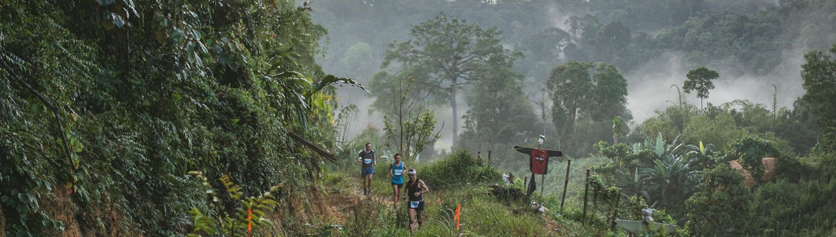
50 km - (50km) 3000m+ elevation gain 3000 elevation loss. Expect a very tough hilly course to push your heart to the limit as this will not be a walk in the park and will need a good training plan before the event to finish the 50km within the 13 hour cut-off. The course will follow the same as the 25km route until the river crossing (CP1) around 7.5km and then a 10km new section (20km total as must return same way) following quiet gorgeous valley with dirt track and single track with almost 100% pristine rain forest with monkey leaping from trees, sound of very loud crickets and just absolute ideal running conditions to put you in that zone you have long lived for until Lentang cp2 17km turn around. You will come back on the same route to the river crossing (bridge now) (CP3 - 26k) - same as cp1, so try to cheer on the others coming in the opposite direction. Back at the river crossing bridge checkpoint you will continue on the same as the 25k route until a timing only checkpoint which will act as a cutoff rerouting at 33km. This next section has some very short but very steep hills that you can get thru mentally by just putting your head down taking short steps until you reach the top then down to the next water checkpoint at 37km. Return same way back for 4km until the timing checkpoint at 41km and turn left into the plantation. Next water checkpoint at 44km. From here paved road the next 4km until around 48km then dirt road until finish behind hotel coming in from back up short hill. A lot has gone into this course and we trust you will appreciate every bit of it. Yes there are plenty of hills, but most are short steep hills that you can overcome mentally if you train with a positive mind with a cando attitude. No pain no gain as they say.
ITRA index/UTMB Qualify race - Finisher of 50Km race can get 2 points for ITRA Endurance Point
(will update google map below as as slight change but Strava above is correct)
- CP1 - River crossing bridge - 11 km - cut-off is 2 hrs 30 min
- CP2 - Lentang - 20 km - cut-off is 5 hrs
- CP3 - River crossing bridge - 29 km - cut-off is 7 hrs
- CP4 - ATV site end of dirt electricity line road - 39 km - cut-off is 9 hrs 30 min
- CP5 - End of plantation before river - 47 km - cut-off is 11 hrs 30 min
- Finish - 53 km - Total time allowed 13 hours.
Food and drink chart for each checkpoint
Water Check point - "NO CUP CONCEPT" only bladder, bottle or foldable cup can refill at Water station.
|
|
Banana |
Orange |
Water |
Lunch Box |
|
CP 1 / 3 (same location) |
✓ |
✓ |
✓ |
|
|
CP 2 |
✓ |
✓ |
✓ |
|
|
CP 4 |
✓ |
✓ |
✓ |
|
|
CP 5 |
✓ |
✓ |
✓ |
|
|
FINISH |
|
|
✓ |
✓ |
|
50km Elev chart |
Distance (Km) |
Accumulated Distance (Km) |
Elevation Gain (M) |
Accumulated Elevation Gain (M) |
Elevation Loss (M) |
Accumulated Elevation Loss (M) |
|
Start Cheringhill to River CP1 |
11 |
11 |
466 |
466 |
545 |
545 |
|
CP1 river to CP2 Lentang |
9 |
20 |
871 |
1337 |
1091 |
1636 |
|
CP2 Lentang to CP3 River |
9 |
29 |
1074 |
2411 |
854 |
2490 |
|
CP3 River to CP4 ATV bridge |
10 |
39 |
715 |
3126 |
611 |
3101 |
|
CP4 ATV - CP5 Plantation finish CP5 finish Cherengin hills |
7 6 |
46 52 |
tbc 284 |
tbc 3410 |
tbc 320 |
tbc 3421
|
27km - 1465m+ elevation gain, 1476m elevation loss, 588m highest point (22 km dirt roads & 2 km cement road)
ITRA index/ UTMB Qualify race - Finisher of 25Km race can get 1 point for ITRA Endurance Point
(will update google map below as as slight change but Strava above is correct)
***Missing new section out to Bukit Tinggi return before CP1***
2 water check points
CP1 - 11 km - (River crossing bridge) - cut off is 2.5 hours
(skip cp 2, 3, 4)
CP5 - 21 km - (Bottom of short steep section before river bridget by homestay after plantations) cut off is 5 hours 30min.
Time limit for 27km is 7 hours (2pm).
|
|
Banana |
Orange |
Water |
Lunch Box |
|
CP 1 |
✓ |
✓ |
✓ |
|
|
CP 5 |
✓ |
✓ |
✓ |
|
|
FINISH |
|
|
✓ |
✓ |
|
27km Elev chart |
Distance (Km) |
Accumulated Distance (Km) |
Elevation Gain (M) |
Accumulated Elevation Gain (M) |
Elevation Loss (M) |
Accumulated Elevation Loss (M) |
|
|
|
|
|
|
|
|
|
Start Cheringhill to B. Tinggi - River CP1 |
11 |
11 |
466 |
466 |
545 |
545 |
|
CP1 River to CP5 bottom steep hill after plantation |
10 |
21 |
715 |
1181 |
611 |
1156 |
|
CP5 - finish Cherengin hills |
6 |
27 |
284 |
1465 |
320 |
1476 |
10 km - (11.3k) 554m elevation gain, 555m elevation loss, 532m highest point (7.2 km dirt roads & 2.8 km cement road)
(2019 map as will update for 2023 as slight change near finish adding 1km)

10 km - (11.3k) 554m elevation gain, 555m elevation loss, 532m highest point (7.2 km dirt roads & 2.8 km cement road)
1 water check point
(skip cp1, 2, 3, 4 and go direct to cp5)
CP 5 - 5.5 km - (bottom of steep hill after plantation) - Cut off is 4 hours
Time limit for 10km is 5 hours
Water Check point - "NO CUP CONCEPT" only bladder, bottle or foldable cup can refill at Water station.
|
|
Banana |
Orange |
Water |
Lunch Box |
|
CP 5 |
✓ |
✓ |
✓ |
|
|
FINISH |
|
|
✓ |
✓ |
|
10km Elev chart |
Distance (Km) |
Accumulated Distance (Km) |
Elevation Gain (M) |
Accumulated Elevation Gain (M) |
Elevation Loss (M) |
Accumulated Elevation Loss (M) |
|
|
|
|
|
|
|
|
|
CP 5 bottom steep hill after plantation |
5.5 |
4.8 |
270 |
270 |
235 |
235 |
|
CP 5 - finish Cherengin hills |
6 |
11.6 |
284 |
554 |
320 |
555 |
|
|
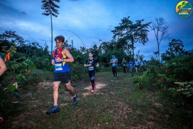
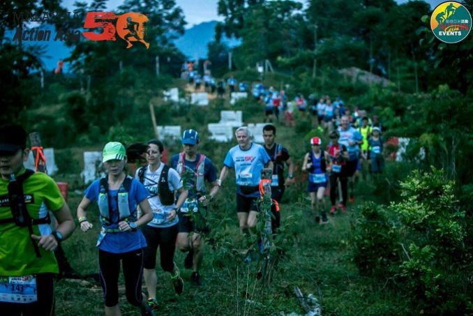
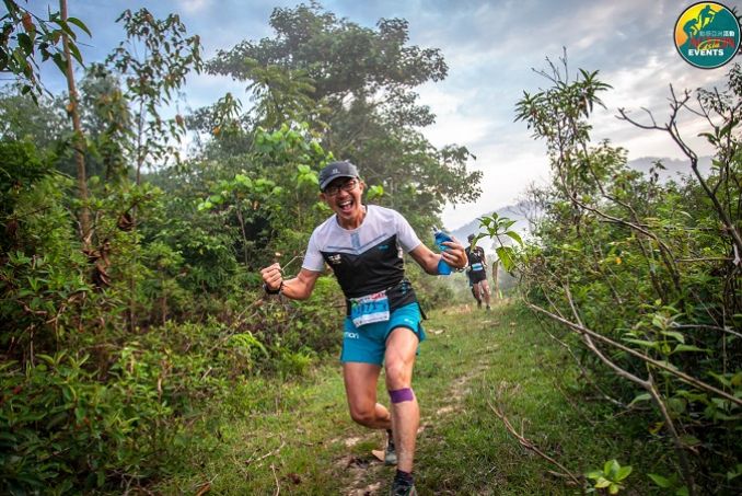
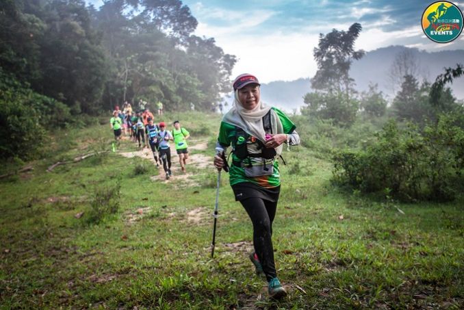
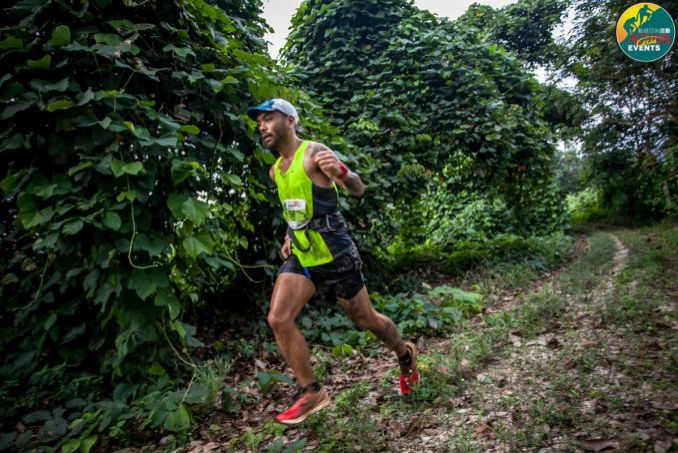
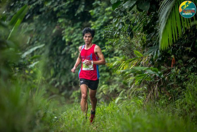
Are you tough enough? |
Pictures of course in Overview on left side of this page.
Course Design:
Designed by Michael Maddess (Race Director & Course Designer) who's organized over 300 events with Action Asia Events and one of the most experienced Race Directors in Asia with a wealth of experience. Michael Maddess an active trail runner, originally from Vancouver, Canada who was Race Director of the World Police Fire Games Triathlon in Canada before moving to Asia, organizes the Action Asia 50 series in Hong Kong (4 races), Taiwan, Thailand, Malaysia, Singapore, 3 day 100km ultra marathon stage events in Mongolia, Nepal, Kazakhstan, Yunnan/Sichuan China, Vietnam and Laos, has organized over 17 Action Asia Challenge adventure races across Asia including Singapore, Malaysia, Taiwan & HK, 2 Vietnam adventure races, 2 Nepal Himalayan Mountain Bike races, over 30 Action SPRINT HK adventure races, 8 Action Asia Off Road HK bike races, worked/competed in numerous other road races/triathlons including finishing 3 Ironman triathlons (10hrs 46min), 1st runner-up in 100km Oxfam trailwalker in 11hrs 16min (record for HK resident) 3x in 13 hrs 25 min, 12hrs 44min, 12hrs 39min, winning team Wilson Trail full & half 5x (78km - 10hr14min), 3rd in HK100 (1st edition) in 12hrs 30min, winner of Sabah 3 day adventure race 3x, 8th overall Gobi 250km race suffering from hypothermia and still holds a couple KOTH HK marathon records. He's also coached dragonboat, soccer and baseball teams, climbed to 16,000+ft in Bhutan, 15,000+ft Nepal Annapurna Basecamp, made it up to 5000m 4Sisters in Sichuan within 24hrs of getting off plane (not recommended) and free jumps off high bridges in Nepal for fun. If he's not outside designing a course, doing something extreme, he's not having fun.
Water Check point - "NO CUP CONCEPT" only bladder, bottle or foldable cup can refill at Water station.


/ITE26-Banner300x100.jpg)
/CBREMKC_9735_HK_Logo web banner-01.jpg)
/RoyalInt300100banner.jpg)
/HysanWebBannerDesign300.png)