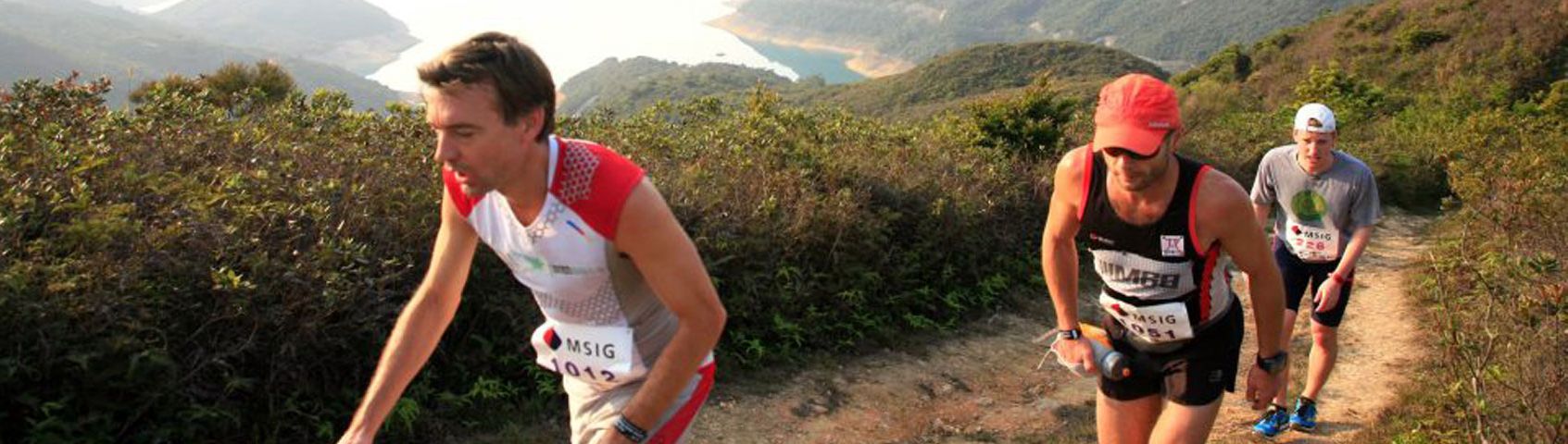
MSIG LANTAU 88 IN DEPTH
Life is for participating, not spectating
To run a marathon is to take a giant leap comprised of many little steps

I may not be the fastest, I may not be the strongest, but I'll be damned if I don't try my hardest.....
OK so you think you can handle the 88km. Well highly recommend on thinking what was the longest hike or run you did this year and see if you have enough training behind you to finish the 88km within the 19 hour cut-off. Why 19 hours? Well we decided to start at midnight and wanted everyone to finish by 7pm as extremely long day already for staff & marshals, but will review the 88km next year after the first edition and welcome feedback, but are confident many will finish well within the cut-off and get an amazing experience out of this Lantau course at the same time.
All human beings should learn before they die what they are running from, and to, and why. - James Thurber
Tung Chung start (Man Tung Road Park - next to Novotel - behind Citygate shopping centre and 7 minute walk from MTR station) - CP1 Pak Mong.
Start - CP 1 Pak Mong - 4.7km (359m gain & 340m loss). Max elev 352m
Starting in the park next to the Novotel Hotel, participants will run around 600m along Man Tung Road to the highway overhead pass and climb up a small 20m high set of stairs then right turn to get to other stairs 100m away going back down on other side of highway by bike lane and follow highway for around 300m until trail entrance heading up to Por Kai Shan where the trail goes from steep to very steep with loose scree rock and a narrow trail but still easy passing all the way up until after 800m or so where single track starts for 200m or so until reaching the main contour trail at an elevation around 352m. Then left turn on main trail for less than 2km down from Por Kai Shan to Pak Mong village. Left turn and out on the highway where the CP1 will be near the underpass entrance where there is a large parking area. (note this is a small change instead of running thru Pak Mong due to village problems and works out 300m shorter for next section so not big deal). Would not think many will need much water for this section so don't need to take more than 1 litre max I would think from start to CP1.

Everyday is a fresh start; don't measure yourself by yesterday's troubles - Dagny Scott Barrios
CP1 Pak Mong - CP2 Nam Shan - 13km (625m gain & 506m loss). Max elev 440m. TOTAL 18KM
This is an interesting section as it will be dark for all and the first section along the side of the highway to the end of the lake is straight forward, then the single track going up is not difficult, until around 1km up around 200m in elevation the trail all of a sudden becomes overgrown and you are at a snails pace for at least 200m in distance and best to walk this fast and not try anything silly at beginning of the race.

After the bush and big climb up to Lo Fu Tau it's easy sailing down to Mui Wo and up well maintained path to Nam Shan.
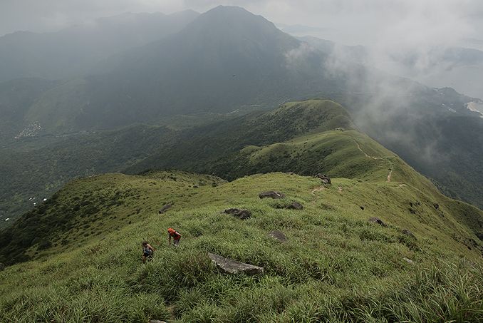
When you come out the trail clears up and eventually around 330m elevation you intercept the main hiking trail that heads up to Lo Fu Tau which is a bit of a relief after going up this section in the dark. Would recommend all to do this section in the day time to familiarize themselves to reduce any swearing on the way up. The good news is it is well marked and difficult to really make any mistakes once you're on the main trail going up to the Lo Fu Tai trail. Once turned right and passing Lo Fu Tau at around 440m elevation and now heading in the Mui Wo direction it's a clean open wide trail with numerous passing opportunities and enjoyable single track down which is why many live in Discovery Bay to enjoy trails like this close by their home.

To know what life is worth you have to risk it once in a while
Once reaching the Olympic trail turn left and a paved single track trail for around 2km down passing thru the backyard of Mui Wo and taking the old Nam Shan village trail that starts behind Luk Tei Tong hidden at the back of Mui Wo. Around 1km going up a single track trail thru the forest from sealevel to around 130m elevation to get to the open grass picnic camping area of Nam Shan check point 2 at the Pagoda.
CP2 Nam Shan - CP3 Nam Shan - 10.86km (750m gain & 750m loss). Max elev 320m (TURN BEFORE RESERVOIR and go up trail to Lo Yan Shan. TOTAL 28KM
While you were sleeping, I was running....

From Nam Shan runners will cross the road and hike up a mixed stone stairs and trail section from 130m elevation at Nam Shan to 230m highpoint on the single track trail at around 260m elevation by the heli pad near the mountain station and then down single track mixed with stone steps to Chi Ma Wan Road and crossing into the Chi Ma Wan Country Park entrance at Shap Long Kau Tsuen. Left turn at the entrance into the campsite area and crossing the river stream at the back (no water in river) near the little outhouse toilet and following the single track bike trail to the Chi Ma Wan Reservoir near the AFCD house at the Dam. This is quite an enjoyable single track as not hilly and can open the legs a little after the stone steps earlier. DON'T CROSS THE RESERVOIR. Turn right just before the reservoir on stone and single track trail on your right heading up to Lo Yan Shan reaching the top at 268m then continuing on the ridge trail going right until drops back down to main Chi Ma Wan Country Park entrance after 2 high points on ridge. From the main CMW entrance it's back tracking up the same single track trail for 3km back to the same water check point at Nam Shan that you came from earlier.
When you're legs get tired, run with your heart....
CP3 Nam Shan - CP4 Pak Kung Au - 7.79km (422m & 218m loss). Max elev 387m. TOTAL 36KM
As soon as you leave the Nam Shan pagoda cp you will slowly start climbing up a fairly nice groomed South Lantau trail which is a little steep for some at the beginning with many prefering to hike until after 2km or so when it starts leveling out and much more runable. Again in the daytime running is one thing, but at night you'll have to be on your toes looking closely at the trail as little rocks here and there to pay attention too, but in large a very runable trail to get back in the rythym especially the last few kilometers before the Pak Kung Au CP. Pay attention to the 3 or so waterfalls the trail passes by as watch your footing as dirt trail quickly turns to large stones then quickly back to single track. For many seasoned Lantau runners this will be their backyard, but for those unfamiliar recommend running the South Lantau trail to familiarize yourself so you know what to expect in the dark.

Don't quit. Suffer now and live the rest of your life like a champion.
CP4 Pak Kung Au - CP5 Tung Chung - 5.15km (102m gain & 413m loss). Max elev 371m TOTAL 41KM

At Pak Kung Au checkpoint (Tung Chung Au) sandwiched between Sunset Peak and Lantau Peak runners will do a right turn on Tung Chung Road and go down the hill only around 100m and stay left going down the old Tung Chung Road around 400m until a large AFCD map board on the left and single track trail entrance heading to Tei Tong Tsai.
This trail is a bit tricky as many hikers don't know it, doesn't get a lot of foot traffic and can get a little greasy at times from the wet dew in the forest so take care when trying to take corners like a race car driver as probably not wise. Once the trail pops out after a couple kilometers on the paved path, it's a right turn staying on the path for the next kilometer to Shek Mun Kap where there will be an old village trail on left by a small carpark you'll have to watch out for that goes direct to the Hau Wong Temple. Passing the back of a college stay on the path heading to the Hau Wong Temple where the Tung Chung cp5 will be located not to far from the entrance. This last section cp4-5 will probably be one of the fastest sections for you in the race.
CP5 Tung Chung - CP6 Ngong Ping - 7.46km (500m gain). TOTAL 49KM

Success in running means leaving your comfort zone. Learn to love your discomfort zone.

At Tung Chung cp5 you DEFINATELY want to do a stretch, make sure you are fully loaded with at least 2litres of liquid and have some food with you and eat food at the cp as the next section is going to really push the body. The good news for many is that it will be a well deserved rest where the single track steep trail going up to the Nei Lek Shan station is almost impossible to run up unless you're superman so you might as well take your time and keep your hydration hose in your mouth most of the way rehydrating and eating on the way up to down as many calories as you can. You'll probably be using your arms to pull yourself up between trees and bush so leave your handheld bottles at home as you'll be happy you brought your hydration system on this section. This is also the first section for the 25km/50km runners who you could be running into if you reach this section after 7pm.
When I want to quit, I always ask myself what I'm made of? That always makes me push thru with extra power...
Running along the paved path to Tin Sam from CP5 is basically sea level until you pass the toilet block by the little river where you go into the single track trail and follow all the way up along a steep ridgeline to the Nei Lek Shan Ngong Ping 360 cable car tower at an elevation of around 550m (note this trail is in better condition than the summer due to some trimming so more enjoyable now), before turning left after the tower on the Nei Lek Shan trail heading around 2km on a contour dirt trail towards Lantau Peak. Fairly flat and will be a sign of relief to open the legs up after the long 3km hike up. Note you will pass the Lantau trail on your right and will continue 100m more to the actual water checkpoint on the road, before backtracking 100m to enter the Lantau trail which goes around Ngong Ping for the 88km. At this CP6 the 25km will go straight towards the Wisdom Poles while the 50km follows the 88km course going back 100m to the Lantau trail turn after the water cp and following the Lantau trail around Ngong Ping popping out by the cable car station where the tourist shops and 7-11 are located.
CP6 Ngong Ping - CP7 Catchwater - 14.8km (645m gain & 977m loss). Max elev 525m TOTAL 64KM

This next station is definately one of the highlights of the course and possibly one of the premier highlights of any race in Asia as absolutely stunning and will be magic for many in the early December dawn, tired, just ran/hiked over 49km, focusing on just getting over the climbing sections and watching the sunrise at the same time. After popping out on the main road in front of the Buddha, it's a right turn down the main road for 2km until the entrance of the Keung Shan ridge line at Ngong Ping Rd & Keung Shan Rd. This is quite a long misleading section so make sure you are again fully loaded with at least the recommended 2 litres (or even 3 litres if you can squeeze it in) and take lots of food for the uphills as you'll be calorie starved by this time and probably questioning your sanity who talked you into this race. The good news are the views will be stunning and before you know it you'll be on a technical downhill heading to the catchwater which we want you to take your time as this is one location we don't want you to injure yourself as litterly in the middle of no mans land. Once on the catchwater left turn and just 1km or so until you see the next water cp.
Keung Shan section - get your camera out but make sure you're loaded with water before you leave the cp.

Anyone can give up., it's the easiest thing in the world to do. But to hold it together when everyone would understand if you fell apart, that's true strength..
CP7 Catchwater - CP8 Shek Pik BBQ - 7.8km (320m elev gain & 340m elev loss). Max elev 324m 71KM
Once you leave the catchwater (elev 92m) you'll be trekking up the Keung Shan Country trail for around 1km straight up to around 292m elevation which is a bit difficult to run and recommend saving your energy here and hiking, but as soon as you reach the flat contour section of the Keung Shan country trail it flattens out and quite enjoyable as going from West to East direction meaning it will be very quiet as rarely see any hikers out in this section as many don't even know this trail exists as a little hidden gem still left on Lantau. heading this far out on Lantau.
The Keung Shan Country trail doesn't get a lot of traffic so they're will be some overgrown plantation on the sides and a little more technical than the more smooth country trails so watch your footing when not admiring the stunning coastal views of the islands and ocean on your right. The trail does a right turn and down a technical trail again until a stone path which pops out at the catchwater where you'll do a left turn on the paved road for around 3km until the Shek Pik BBQ CP.

Enjoy running across the Shek Pik Reservoir as quite stunning looking across the water and daydreaming of what you'll be climbing next. Congradulations you've made it too the Shek Pik BBQ and done almost 71km, but guess what, the biggest climbs of the race are in front of you so not the time to get nervous, but time to relax and just go one foot at a time.
CP8 Shek Pik BBQ - CP9 Pak Kung Au - 7.7km (883m elev gain & 685m loss). Max elev 934m TOTAL 79KM
Of course it's hard. It's suppose to be hard. If it were easy, everybody would be doing it. Hard is what makes it great. - A league of their own
Beautiful contour trail slowly climbing in elevation and then bang a massive vertical climb going straight up to the top of Lantau Peak where the fun begins..

Happiness is a jouney... Not a destination. - Ben Sweetland
When you leave the Shek Pik Reservoir you'll surely be questioning your sanity if you haven't yet so make sure you prepare well as this next section could make or break your race plans all too terribly if you don't take the time to prepare. If you have friends this is one location you want to definately send them (and CP9) for moral support or to give you some tissue to stop you crying. Make sure you are fully loaded again and take a big gulp of liquid before you leave the cp. I would use this next section to definately eat as much as possible before the steeper climb up the backside of Lantau Peak where you'll need your hands for manouvering between scree. If you take your time you'll be fine as first part is runnable for first few kilometers, then it just gets too steep and you'll be going at a snails pace up the trekking section until you reach the Lantau trail just below Lantau Peak.
Absolute stunning scenery so enjoy it while it lasts as you're almost there and should put your hand in the air and behind your head for a personal pat on the back when climbing over the 934m tip of Lantau Peak as you wont be going up that high any more. Take your time on the way down to the Pak Kung Au as with just over 10km left in the race you can't afford any injuries here for a small mistake like a rolled ankle or something. If the legs are tightening up try to stop and lean against a rock and do some 15 second each leg streches to try getting the lactic acid out. Put your leg up against a steep slope on the side of the trail every 20-30 minutes and stretch out the hamstrings to keep the blood flowing as near the end of the race everything will be tightening up and you'll be on survival by this time. If you using salt/electrolyte tablets make sure you use them first in your training to make sure you get use to them and the frequency of dosage.
CP9 Pak Kung Au - Finish Tung Chung - 9.4km (505m elev gain & 885m loss). Max elev 773m - TOTAL 88KM
Pain is temporary. Quitting lasts forever.
CP 9 at the Pak Kung Au is one place again you may want your friends to come along for screaming support as many of you will need it. The good news phychologically is that this is the LAST water cp. You'll be very happy on one side but not happy looking up at Sunset Peak in front of you shaking your head who the hell designed this brutal course. Come on, look at the bright side as nobody is pushing you to run now as you can walk up the stairs for a well deserved break. Just don't stop and start taking photos as you want to make sure you keep going to make the final cut-off at 19 hours.

Once reaching the high point near 800m (Pak Kung Au is 330m) the trail smooths out and runnable down staying left at the cabins and following the contour trail until you meet the Wong Lung Hang AFCD map sign board.

Stay right and keep on same Lantau trail until 200-300m before a sharp LEFT turn heading to Por Kai Shan. DONT stay on the path going to Mui Wo or you're in big trouble.
You have to fight thru some bad days to earn the best days of your life

If at first you don't succeed, you are running about average.- MH Alderson
Follow the contour trail around to Por Kai Shan and steep left single track trail final 2km down to Tung Chung. Last downhill and you can see the Tung Chung finish by the Hotel (looks like a big movie screen and the last numerous hours feels like a movie to you). Same route back that you started at beginning of race until Man Tung Road Park for 88km.
Now for some well deserved food, drinks and rest as you just completed a total gain of over 5000m for 88km.
You say I dream too big. I say you think too small.
Written by Michael Maddess
(HK Trailwalker 11 hr 16 min, 3x winner of 150km Sabah Adventure Race, Winner 78km Wilson trail, KOTH age group wins, Winner North Face Guilin Adv race, 3x Ironman Triathlete and many other podium results). Race Director & Course Designer over 150 races).
/CBREMKC_9735_HK_Logo web banner-01.jpg)
/RoyalInt300100banner.jpg)
/HysanWebBannerDesign300.png)