24 Oct-22 Nov, 2020
Finished
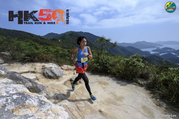
2020 - HK50 - Hong Kong Island VIRTUAL


Course 比賽路線
Two Distances 2個距離
50Km (50.7Km) - elevation gain 2212m & elevation loss 2400m (Max elev 438m) - 24 hour cut-off
24Km (24.9Km) - elevation gain 926m & elevation loss 1114m (Max elev 418m) - 24 hour cut-off
50公里 (50.7公里) - 總爬升2212米,總下降2400米 (最高點 438米) – 限時 24小時
24公里 (24.9公里) - 總爬升926米,總下降1114米 (最高點 418米) – 限時 24小時
Start time: 7:00AM
起步時間:早上7:00
50Km公里
50Km Route – (Distance 50.7km, 2212m elevation gain, 2400m elevation loss) (Total 4 main food/drink CPs) (Route update for 2019)
50公里路線 – (距離50.7公里, 總爬升 2212米, 總下降2400米) (4個提供食物及飲品檢查點) (2019路線有所修改)
UTMB Qualify race - Finisher of 50Km race can get 2 points for ITRA Endurance Point
UTMB 資格賽 - 完成50公里賽事可取得ITRA分數(ITRA Endurance Point) - 2分
Please find the details of certified tracks below. 有關認証路線請參閱以下連結。
https://tracedetrail.com/index.php/en/trace/trace/87877
Race starts from Peak at Lugard Road opposite Peak Café - HK trail all the way to Wong Nai Chung Gap with addition of Mt Bennet loop. When arriving at Wong Nai Chung Gap use Sir Cecil Ride entrance behind petrol station and proceed along Sir Cecil Ride (passing Mt Butler Rd - Quarry - Braemar Hill - Mt Parker Rd - Hong Pak Country Trail - Mt Parker Rd - Qarry Gap Tai Fung Au - Hong Kong Forest Track Mount Parker Section - Hong Kong Forest Track Boa Vista Section - Boa Vista Trail up to Quarry Hap Tai Fung Au - Mt Butler - Jardine Lookout - Violet Hill - Tze Lo Lan shan Path (catchwater) - Wong Nai Chung Gap finish.
由山頂盧吉道起步沿港島徑及加入班納山路段至黃泥涌峽。當抵達黃泥涌峽後,前往金督馳馬徑,經畢拉山道、寶馬山、柏架山道、康柏郊遊徑、柏架山道、大風坳、港島林道 柏架山段, 港島林道 美景路段, 野豬徑返回大風坳, 畢拿山、渣甸山、紫羅蘭山、紫羅蘭山徑(引水道),返回黃泥涌峽終點。


(Intermediate Cut-off for 50Km) - Will be 11:30am or 4.5hrs after start of race at 25km half way point cp (Wong Nai Chung Gap). This means all 50k participants must be able to complete the first 24km in 4.5hrs to be allowed to continue the 2nd half of the course.
**Participants cut at CP5 will walk approx 500m downhill to Finish.
50公里中途關門安排 – 如參加者未能於4.5小時 (早上11:30)前到達CP2(檢查點2),將絕不能繼續下半段賽程。
**參加者未能在時限前到達CP5(檢查點5),須步行約500米返回終點。
24Km公里
24Km Route – (Distance 24.9km, 926m elevation gain, 1114m elevation loss) (Total 1 food/drink CP)
24公里路線 – (距離24.9公里, 總爬升 926米, 總下降1114米) (1個提供食物及飲品檢查點)
UTMB Qualify race - Finisher of 24Km race can get 1 points for ITRA Endurance Point
UTMB 資格賽 - 完成24公里賽事可取得ITRA分數(ITRA Endurance Point) - 1分
Please find the details of certified tracks below. 有關認証路線請參閱以下連結。
https://tracedetrail.com/index.php/en/trace/trace/87876
Race starts from Peak at Lugard Road opposite Peak Café - HK trail all the way to Wong Nai Chung Gap with addition of Mt Bennet loop.
由山頂盧吉道起步沿港島徑及加入班納山路段至黃泥涌峽


Cut-offs are subject to race discretion on race day as Race Director has final say.
關門時間 – 賽事總監在比賽當日擁有最終決定櫂
Insurance - The event has its own public liability insurance coverage, but we recommend that all participants get their own personal accident coverage to cover any personal accidents.
保險 – 本活動已購買公眾責任保險,但建議所有參加者購買個人意外保險以保障任何個人意外。
Medical - As this event involves going into the mountains we recommend all participants to have gone to a medical checkup before the event to make sure you are physically fit enough to handle this kind of physical challenge.
醫療 – 由於活動於山上進行,建議所有參加者進行醫療檢查,以確保身體狀況能應付有關挑戰。


/ITE26-Banner300x100.jpg)
/CBREMKC_9735_HK_Logo web banner-01.jpg)
/RoyalInt300100banner.jpg)
/HysanWebBannerDesign300.png)